
Place Story · Geography decides everything

Bhagalpur: how a river bend made a kingdom, a university and a silk city

Start with the land. The Ganga, its rich silt and a few hard rocks decided where people settled here, who ruled them and how they earned. Follow that chain through 2,500 years to today's schemes.

Listen to the podcast · with Ujjwal, 4 min

A friendly chat through the land, the chain of events and every era. In Hindi and English.

  1. 🌍 Land
  2. 🔗 Chain
  3. 🎓 Hub
  4. ⏳ Through time
  5. 🦅 Bird's-eye view

1 · Start with the land

What the land gave Bhagalpur

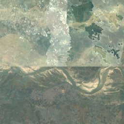
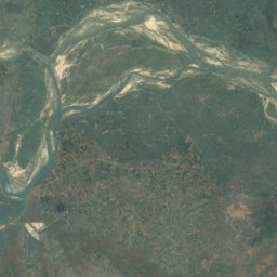
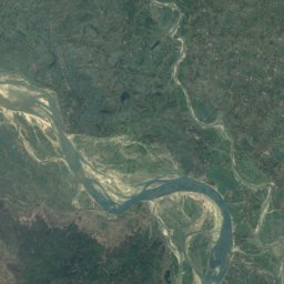
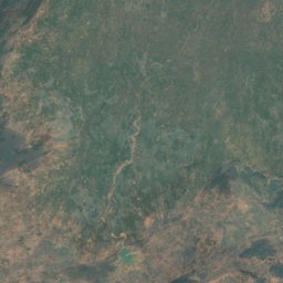
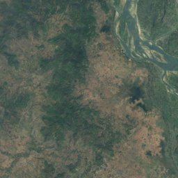
Satellite: Sentinel-2 cloudless 2016 by EOX (contains modified Copernicus Sentinel data, CC BY 4.0). Boundary: DataMeet (CC BY 2.5 IN). River courses © OpenStreetMap contributors (ODbL). Pins and shaded areas are approximate.

☀ Climate

Humid subtropical (monsoon type)

Rain
About 1,200 mm a year, mostly June–September from the south-west monsoon
Temperature
Hot summers near 40 °C in May; cool winters around 10 °C in January
Seasons
Summer, monsoon (floods on the north bank), winter (rabi crops)

🌱 Soil

Young alluvium (khadar) along the Ganga and on the diara islands, renewed by floods every year; older alluvium away from the river. Good for rice, wheat, maize, bananas and mangoes.

📌 Land facts to remember

Main river
Ganga, west to east, splitting the district
Smaller rivers
Chandan (from the south), Kosi (meets the Ganga just north-east)
Landforms
Flat Gangetic plain, diara islands, rocky outcrops at Sultanganj and Kahalgaon
Minerals
No major mines inside; river sand. Coal comes from the Rajmahal coalfield in Jharkhand
Wildlife
Gangetic dolphin (Vikramshila sanctuary, 1991)

2 · One chain, six links

From a river bank to a city: how one thing led to the next

🌍 A river, rich silt and a few hard rocks

The Ganga and the Kosi spread fresh silt every year. At Sultanganj and Kahalgaon, hard rocks pin the river to a fixed bank, rare on a plain where rivers keep shifting.

Look at the map above. The Ganga enters the district near Sultanganj and leaves near Kahalgaon. On most of the Gangetic plain the river swings from side to side every few decades, so towns struggle to stay on its bank. Here, two outcrops of hard rock, the last edge of the Rajmahal hills, stick out into the water. They hold the channel close to the southern bank.

North of the river is the opposite world: the low, flood-prone land of Naugachhia between the Ganga and the Kosi. Floods every monsoon are a curse for houses and roads, but they also lay fresh silt, which is why bananas and maize do so well there. South of the river, small rain-fed rivers such as the Chandan and the Gerua come down from the uplands of Banka.

Rock points
Sultanganj (Ajgaibinath, Jahangira) and Kahalgaon (Teen Pahari islets)
Rivers
Ganga; Kosi joins near Kursela; Chandan, Gerua, Champa from the south
Protected stretch
Vikramshila Gangetic Dolphin Sanctuary, Sultanganj to Kahalgaon (1991)
The rocky islets of Kahalgaon from Bateshwar hill
The rocky islets of Kahalgaon from Bateshwar hill · Deepak Kumar Sharma · CC BY-SA 3.0
1 / 6

3 · What the region comes here for

Bhagalpur as a hub: institutions and infrastructure

Bhagalpur is a hub for education

Why the villages around Bhagalpur send their children here

Bhagalpur is the education and services capital of a wide belt of eastern Bihar and the Santhal Pargana side of Jharkhand. A student from Banka, Godda or Naugachhia usually takes a bus or train to Bhagalpur for college, coaching, a hospital or a court case. That pull has a history.

Who depends on it: Bhagalpur and Banka districts (the division), the Naugachhia side across the river, Munger, Katihar and Purnia nearby, and Godda, Sahibganj and Dumka in Jharkhand.

  1. 1

    The British made Bhagalpur a revenue district and later a divisional headquarters, so courts, offices and officials gathered here.

  2. 2

    Officials, lawyers and merchants wanted schools and colleges for their children, so T.N.B. College opened in 1883, one of the oldest colleges in Bihar.

  3. 3

    After independence the state placed a university (1960), an engineering college (1960) and a medical college (1971) here, because the colleges and the division HQ were already here.

  4. 4

    Thousands of students from villages moved in, which created lodges, hostels, coaching institutes, libraries and bookshops: a whole student economy.

  5. 5

    The medical college hospital became the referral hospital for the region, and rail, road and the 2001 bridge made Bhagalpur even easier to reach. More people came, and the hub grew.

  • T.N.B. College · 1883

    Tej Narayan Banaili College, among the oldest colleges in Bihar; now part of the university.

  • Tilka Manjhi Bhagalpur University · 1960

    Set up as Bhagalpur University in 1960 and later renamed after Tilka Manjhi; its colleges spread across the division.

  • Bhagalpur College of Engineering · 1960

    One of Bihar's older government engineering colleges.

  • Jawaharlal Nehru Medical College and Hospital (JLNMCH) · 1971

    Trains doctors and runs the big referral hospital that patients reach from across eastern Bihar and nearby Jharkhand.

  • Bihar Agricultural University, Sabour · 2010

    Grew out of an agricultural college started in 1908; research behind Zardalu mango and Katarni rice.

  • IIIT Bhagalpur · 2017

    An Indian Institute of Information Technology set up in public–private partnership.

  • Commissioner's office and civil courts

    Bhagalpur is the HQ of Bhagalpur division (Bhagalpur and Banka). Appeals, land cases and offices bring people in every day.

  • Bhagalpur Junction and Vikramshila Setu · 2001

    The railway junction on the Sahibganj loop line (Malda division, Eastern Railway) and the 2001 bridge to Naugachhia tie the region to the city.

Also a hub for

🛒 Trade: silk trade from Nathnagar and Champanagar, and wholesale markets for the villages around

⚡ Power: NTPC Kahalgaon (2,340 MW) supplies power to Bihar and other eastern states

🛕 Pilgrimage: Sultanganj is the starting point of the Shravani Mela kanwar route to Deoghar

Exam angle: A Mains-style point: administrative centres become education and health hubs, because officials, courts and early colleges come first and everything else follows. Bhagalpur shows this cause and effect clearly.

4 · Slide through time

Every era, every dimension, and what it caused

Each era shows the land, economy, society, infrastructure and who governed. Tap a cause to jump to the era that produced it.

The land forms · before 600 BCE

Before any king, the river did the work

The rocky islets of Kahalgaon from Bateshwar hill
Deepak Kumar Sharma · CC BY-SA 3.0

Land & environment

The Ganga and the Kosi laid down thick layers of silt over thousands of years. Hard rocks of the Rajmahal hills' edge poke out at Sultanganj and Kahalgaon.

Economy

Farming of rice on the flood plain, fishing in the river.

Society

Village communities along the higher river banks. The epics later remember this land as Anga, Karna's kingdom.

Infrastructure

The river itself is the highway; boats are the main transport.

Who governed

Clan and tribal chiefs; no large state yet.

This led to

Think like an examiner: Why do rocky outcrops matter on a plain like Bhagalpur's?

1 / 7

5 · Bird's-eye view

All of Bhagalpur on one page

The whole page on one image: the land, the six-link chain and every era. Save it for revision or send it to your study group.

Keep exploring

Sources

Checked 15 Nov 2026. Pins are placed approximately.